

Thousands of Irish immigrants, escaping the poverty of Ireland, came to America in the 19th century seeking a better way of life. Many of these immigrants drifted West to build railroads and other massive engineering projects such as canals and bridges. Some of these men and their families also came South as free laborers or as indentured servants. Several large engineering projects in Antebellum South Carolina are monuments to these Irish workers.
 The 1820’s was a period in which Americans sought to create internal improvements in their transportation and communication system. It was no different in South Carolina. Many in Charleston desired to tap the wealth of the West. They dreamed of a series of canals to connect the Mississippi River with the waterways of South Carolina and subsequently the city of Charleston. To accomplish this feat a plan was drawn up and the first canals were to be built in South Carolina to improve its own transportation system from the backcountry to the coast. It was an age of “canal fever.”
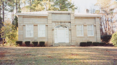
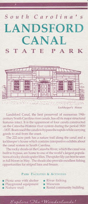
 Two of the projects to accomplish this goal were the Landsford Canal and the Columbia Canal. The Landsford Canal , near Lancaster, South Carolina, was designed by the architect Robert Mills and it was located on the Catawba River and bypassed the rocks and shoals of the main river channel. It was to provide a direct route to upstate settlements and towns on the fall line and beyond to the city of Charlestown. Construction began in the 1820’s. African slave labor was used but slaves were valuable in this plantation economy and it was cheaper to use Irish-Americans workers. In addition, some of these Irishmen were skilled in the process of cutting stone and building canals. They were recruited from the northern states to build the 2 mile long canal. They used mostly physical strength and animal power with some explosives to build it. The canal was not a financial success and by 1840 had been superseded by the new technology of railroads.
 Another canal that also employed Irishmen was the Columbia Canal. It was started in 1824 and was also designed by Robert Mills. Its goal was to again make it easier to transport goods from the backcountry to Charleston and back. It took more than $209,000 to build it. Irish indentured servants were employed on this project. Hundreds of these men died in building it due to disease and accidents and a memorial was dedicated to them on the site of the canal in 2008. It too failed in its original purpose. Later in 1891 this canal was rebuilt and extended to supply drinking water to the city of Columbia and surrounding areas and was also used to generate electricity as the 20th century dawned in the Capitol City of the Palmetto State. Today the memorial to the Irish workers is at the edge of the old canal and is shaped like the letter "I" for Ireland.
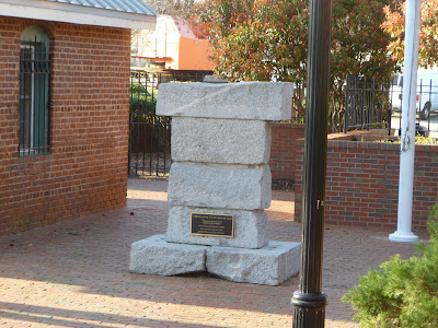
 Irishmen also appear on South Carolina’s northwestern mountain frontier. This time they are employed by a railroad. They were there to build the Blue Ridge railroad and a series of tunnels through the mountains of South Carolina, North Carolina, and Tennessee. The railroad’s terminus was Cincinnati, Ohio. Once again investors from Charleston were involved. They hoped this railroad from Charleston to the Ohio River Valley would tap the wealth of that growing region. The railroad construction was begun in the 1850’s. In 1856 the tunnel at Stumphouse Mountain was begun. It was to be one of the longest railroad tunnels in the United States. The George Collyer Company from London ended up as the eventual contractor for the project. They contracted Irish workers for the job and transported them to the area. These Irishmen created a town on top of Stumphouse Mountain called Tunnel Town.
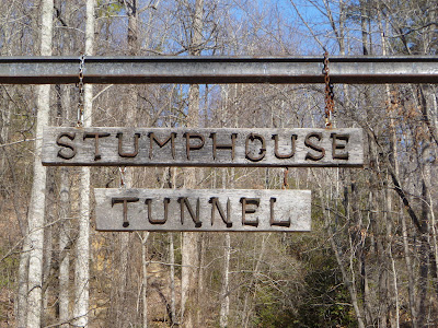
 Tunnel Town had stores, saloons, a post office, a school, a boarding house, 3 blacksmith’s shops and a Catholic church. It also had daily stagecoach service. At the foot of Issaquena Falls and close by the town was Wagener’s Powder Mill. The mill had been opened by a German immigrant to supply black powder for blasting for the workers. The height of Tunnel Town’s population was 1,282 people. Father Jeremiah Joseph O’Connell arrived from Ireland to offer spiritual guidance to the town. He was dismayed by the drunkenness and lawlessness he found in Tunnel Town. It was said that there were more saloons than churches. Father O’Connell used his influence to get the railroad to fire anyone that did not remain sober. He built a Catholic church and dedicated it to St. Patrick. He also established a school for the education of the workers' families.
 The work was hard. The men worked 12 hours a day and 6 days a week. They mostly used sledgehammers and hand drills to create the tunnel. Drilling was slow. One foot per hour per hole was the rule. Black powder, the predecessor to dynamite, was used to blast the blue granite rock. Working on the railroad and tunnel proved dangerous work. Death was not uncommon as reported by the local Keowee Courier newspaper. Some workers slipped and fell to their death in shafts, some were crushed by cave-ins, others died from such things as premature powder explosions, or by being scaled by the steam of a locomotive.
  Today, 1,617 feet of the tunnel is exposed. The state spent more than a million dollars on the railroad and the tunnel. Only about 2/3’s of the tunnel was completed. Some sections in the interior are now flooded. Work on it was abandoned in 1859. Then came Civil War and the idea of this proposed railroad never again saw the light of day. The tunnel at Stumphouse Mountain is now a South Carolina state park. The tunnel , a constant 56 degrees year round, was used for a time in the 1940’s and 1950’s by Clemson University to make its famous Blue Cheese. This operation has since moved to the Clemson campus which is nearby. There is little on the top of the mountain to indicate the presence of Tunnel Town today.
From the Wateree to the Capitol City and from the Capitol City to the Blue Ridge of the Keowee, “Paddy” was at work in 19th century South Carolina as he was on all the subsequent frontiers of America. Happy Saint Patrick’s Day and Erin Go Braugh!

Andy Thomas
Sources Used to Write this Blog: 
Wikipedia:
1) Landsford Canal: http://en.wikipedia.org/wiki/Landsford_Canal
2) Stumphouse Mountain Tunnel: http://en.wikipedia.org/wiki/Stumphouse_Mountain_Tunnel
“Columbia pays tribute to Irish laborers who built canal,” Adam Bean, The Rock Hill Herald, September 8, 2008: http://www.heraldonline.com/2008/09/06/797474/columbia-pays-tribute-to-irish.html
Oconee Heritage Center Website: http://oconeeheritagecenter.org/eratwo.html
The Historical Marker Database Website: http://www.hmdb.org/marker.asp?marker=15041
Landsford Canal State Park Field Trip: http://www.oldeenglishconsortium.org/TAH/content/curriculum/lesson_plans/grade8/grade8_87landsford_canal_park.pdf
“Robert Leckie and the Landsford Canal,” Louis Pettus, on rootsweb website: http://freepages.genealogy.rootsweb.ancestry.com/~waxhaw/pettus/leckie_landsford.html


 General Sam Houston
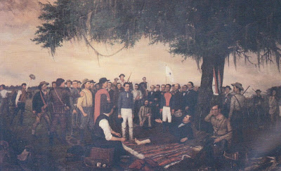 Surrender of Santa Anna


